UAV-Borne Imagery Can Supplement Airborne Lidar in the Precise Description of Dynamically Changing Shrubland Woody Vegetation


May 2022, Remote Sensing 14(2287)
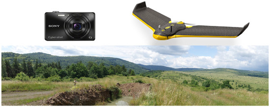
Airborne laser scanning (ALS) is increasingly used for detailed vegetation structure mapping; however, there are many local-scale applications where it is economically ineffective or unfeasible from the temporal perspective. Unmanned aerial vehicles (UAVs) or airborne imagery (AImg) appear to be promising alternatives, but only a few studies have examined this assumption outside economically exploited areas (forests, orchards, etc.). The main aim of this study was to compare the usability of normalized digital surface models (nDSMs) photogrammetrically derived from UAV-borne and airborne imagery to those derived from low- (1–2 pts/m2) and high-density (ca. 20 pts/m2) ALS-scanning for the precise local-scale modelling of woody vegetation structures (the number and height of trees/shrubs) across six dynamically changing shrubland sites. The success of the detection of woody plant tops was initially almost 100% for UAV-based models; however, deeper analysis revealed that this was due to the fact that omission and commission errors were approximately equal and the real accuracy was approx. 70% for UAV-based models compared to 95.8% for the high-density ALS model. The percentage mean absolute errors (%MAE) of shrub/tree heights derived from UAV data ranged between 12.2 and 23.7%, and AImg height accuracy was relatively lower (%MAE: 21.4–47.4). Combining UAV-borne or AImg-based digital surface models (DSM) with ALS-based digital terrain models (DTMs) significantly improved the nDSM height accuracy (%MAE: 9.4–13.5 and 12.2–25.0, respectively) but failed to significantly improve the detection of the number of individual shrubs/trees. The height accuracy and detection success using low- or high-density ALS did not differ. Therefore, we conclude that UAV-borne imagery has the potential to replace custom ALS in specific local-scale applications, especially at dynamically changing sites where repeated ALS is costly, and the combination of such data with (albeit outdated and sparse) ALS-based digital terrain models can further improve the success of the use of such data.